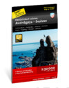
Høyfjellskart Lofoten Austvågøya – Svolvær 1:30000 Calazo
16,90 €
This is one of three unique maps over Lofoten with a lot of detail that has never been seen before. The terrain information on the map is taken from aircraft laser scanning.
Availability: 5 in stock
Product Description
Høyfjellskart Lofoten Austvågøya – Svolvær 1:30000 Calazo
This is one of three unique maps over Lofoten with a lot of detail that has never been seen before. The terrain information on the map is taken from aircraft laser scanning. Mountain slopes, bigger rocks, watercourses, and glaciers appear with an accuracy that matches reality for the first time. A 1:30,000 scale map provides accurate information and is a great aid for those who want to go on a summit hike, fish, climb, or leave the marked trails on the valley floor and find their own routes up in the high mountains. It is made of the Tyvek material, which is water-repellent, tear-resistant, and lightweight.
Reviews
Calazo
Calazo is a publishing company founded by two enthusiastic hikers who embarked on their journey by creating a guidebook for downhill skiing destinations in Sweden called “Svenska Topturer” in 2004. This endeavor’s success led to the publication of “Stockholms Friluftsliv,” a guidebook for Stockholm’s excursion destinations. Encouraged by public interest and media recognition, they transitioned from their regular jobs to pursue publishing hiking books, eventually expanding their team to include writers, artists, and cartographers.
Specializing in camping and route guides initially, Calazo identified the need for more durable maps for outdoor enthusiasts. Since 2010, they have been producing maps made from Tyvek material known for its water and tear resistance. Their meticulous map development process includes data from various sources such as Metsähallitus Nature Services, aerial and satellite images, laser scanning data, and trail network information, often collaborating with experts like Professor Peter Jansson from Stockholm University. Beyond maps, their portfolio includes sports guides for activities like climbing, kayaking, and excursion skating, as well as route guides for popular European hiking destinations. They also offer educational books covering topics such as food drying, first aid, and alpine plants to aid hikers in developing their skills and knowledge.


